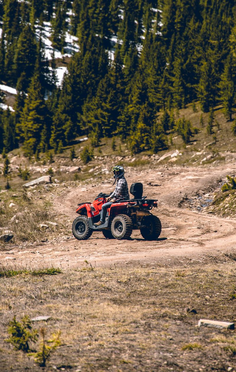
OHV And Off-Roading On Donner Summit
Donner Summit is renowned for its breathtaking vistas, rich history, and above all, its role as a gateway to outdoor adventures. At the top of most visitors’ lists are human-powered activities like Nordic skiing, mountain biking, hiking, and climbing. Yet another exciting way to explore the region is by traversing the dirt roads known as OHV (Off-Highway Vehicle) routes. From iconic to hidden gems, here’s a small taste of what awaits you.
Before You Start
Before heading out any of the OHV trails listed, take time to acquaint yourself with OHV laws, restrictions, and closures. Many of these trails traverse private property, making it crucial to stick to designated paths and heed posted instructions. Also, make sure your vehicle is up to the adventure; help may not be easy to get. For more information on how you can Tread Lightly while using your OHV, follow this link.
You Are Responsible For Yourself
OHV trails are a challenge, with many sections demanding a genuine 4WD vehicle with high clearance to pass. Every year, numerous individuals find themselves stuck and potentially stranded for days. If you are NOT prepared for this, we suggest exploring one of the numerous other attractions on Donner Summit, such as hiking the Royal Gorge trails. Equally stunning, yet without the worry or danger.
Start With US Forest Service
Before traveling to any of these trails, be sure to visit the US Forest Service OHV landing page or better yet call the Truckee Ranger District office at (530) 536-0417 to confirm the area and trails are open. Even in normal snow years, many high elevation trails are not open until after Memorial Day.
Summit Lake OHV Trail
Current Trail Status | Map & Full Details
Beginning just beyond the Johnson Canyon Trailhead, this out-and-back OHV trail leads to a tranquil lake surrounded by lush vegetation and towering trees, providing a sense of escape from the nearby hustle and bustle of I-80. It’s advisable to have a high clearance four-wheel-drive vehicle to tackle this trail. Plan on a sustained steep uphill on the way in and an equally unrelenting steep downhill on the return.
Soda Springs and Foresthill Divide Roads
Soda Springs Road Map & Details | Foresthill Divide Road Map & Full Details
This 20-plus mile unpaved route from Serene Lakes to Robinson Flat (and then out to Foresthill and Auburn) is moderately challenging for a passenger car with above average clearance. It provides stunning views into the North Fork of the American River Canyon. 4WD and a companion vehicle is recommended since the road can be rough and tow trucks (or any other services for that matter) are unavailable. Start down from the southeast corner of Serene Lakes on Soda Springs Road, skirt the Onion Creek Experimental Forest, cross the North Fork, and enter some of the most remote country you’ll find in central California. Bear right at the junction with Foresthill Divide Road, pop out onto pavement at Robinson Flat, and cruise to Foresthill and Auburn through fire-scarred parts of Tahoe National Forest.
Fordyce Jeep Trail
Current Trail Status | Map & Full Details
Near the Cisco Grove Campground and Resort lies a variety of challenging OHV trails, including one of the Sierra’s premier ones—the Fordyce Jeep Trail. However, this trail isn’t suitable for beginners or even intermediates.
What To Expect
It features many tight sections over miles of large, steep, and awkwardly positioned boulders. Translation – rollovers are not uncommon. Be prepared for deep water crossings that may become impassable during high water flows. Mechanical or body damage is frequent unless your vehicle is heavily modified. A minimum recommended tire size of 33 inches and traveling in a group with at least one winch-equipped vehicle is highly advisable.